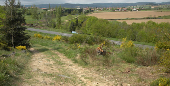
Out of the hills to the road on the way to Le Puy, France, 2009.
Yummy Sleeping
The Miam Miam Dodo Guides to Walking in France
One of the best resources for Santiago pilgrims and other long-distance walkers in France is a series of guides with the funny name Miam Miam Dodo. This is French baby talk that roughly translates to “Yum Yum Nighty Night”.

Or, as the fabulous Google language translator reads it, “Yummy Sleeping”.
(By the way, the Google translators are great tools for planning a trip, writing emails to request information or make reservations, and for learning a language. Although the translations are sometimes amusing – as above – and often need a bit of interpretation themselves, they generally do a good job of getting the point across.)
MMD is not a trail guide, per se. Rather, it’s a supplementary guide filled with information about where to find food (nourriture), drink (boissons), sleep accommodations (hébergements, logements), provisions (ravitaillement), water (l’eau), other services and transportation.
Each pair of pages has a map showing a rough, dotted line of the trail, with a numbered list of resources in each village the trail passes through, or near. Anything useful within 5 kilometers (3 miles) of the trail is indicated. The opposite page has detailed address and contact information keyed to the numbers on the map. Although some roads, side trails and variants are shown, they are not intended for navigation. Whereas each member of a group of walkers might carry a trail guide, they can probably share a single Miam Miam Dodo.

The first thing I like about Miam Miam Dodo guides is their attitude. There’s a true ultralighter’s sensitivity to weight, how to minimize it and how to shed it. It’s designed to be expendable. The back cover even shows the weight of the whole book, and the weight after removing the introductory pages. For example, the guide on the route from Arles, states that the total weight is 210 grams (7.4 ounces), but only 175 grams without the prologue. That’s over an ounce right there!
They are printed on thin newsprint, and it’s easy to tear out the pages (several a day) as you move along the trail. In practice, I also remove the covers, further reducing the starting weight.
Secondly, the guides are written by experienced walkers who know what’s important for happy walkers to stay happy on the trail. They are updated annually, and are informed by reports and comments from other hikers. In a very concise, visual form, they provide detailed information about the most common needs of a randonneur, whether traveling on foot, bicycle, with a donkey, or in some cases, in a kayak or canoe.
Miam Miam Dodo is published in France by Editions du Vieux Crayon. Their original guide follows the GR-65, the Chemin de Saint-Jacques-Compostelle (the Camino de Santiago de Compostela, or Saint James Road), from Le Puy-en-Velay to St-Jean-Pied-de-Port.
Since then, they have added other guides describing several of the popular routes in France. Here are English descriptions (translated by Google) of the most valuable Miam Miam Dodo guides for hiking in France.
GR 65 ~ Le Puy en-Velay to St-Jean-Pied-de-Port. (@ Amazon.Fr)
GR 70 ~ The Robert Louis Stevenson Trail. (@ Amazon.Fr)
GR 653 ~ Arles (France) to Puente la Reina (Spain). (@ Amazon.Fr)
The Canal from Nantes to Brest. (@ Amazon.Fr)
The Canal du Midi – from Toulouse to Sète. (@ Amazon.Fr)
The Canal de Bourgogne – Migennes to St-Jean-de-Losne. (@ Amazon.Fr)
The Loire River – from the source to the sea. (@ Amazon.Fr)
All of Miam Miam Dodos have a common style. Here are examples of two facing pages from the 2007 edition of the GR 653, Voie d’Arles guide. Note – the latest edition extends the coverage from Col du Somport (on the Spanish border) all the way to Puente la Reina, where the route joins the famous Camino Frances. They’re getting better all the time!

On the this map page, the dark dotted line represents the main trail. There is also an orange dotted line that indicates an alternative route. The little gray and red “mileage markers” show the distance in kilometers between two redheaded “pins”. For example, it is 2.6 kilometers between the villages of Montferrand and Avignonet-Lauragais. In this sample, there are seven numbered icons indicating various services. These are all detailed on the facing page (below). As you can see, there is a good deal of basic information presented in an easy to use style.

On the detail page, the little flag symbols represent what languages other than French are spoken.
Bottom line…
If you plan to walk one of the trails covered by Miam Miam Dodo, these are the single best and simplest guides to the services you’ll need. One of these, along with the relevant topoguide from FFRandonnée, will give you most of the available choices for whatever you’ll need. If you’re prepping your first pilgrimage, it’s worth buying one to study before you go, but you can also buy the latest edition when you get to France. Highly recommended by Longwalking.


July 15th, 2011 at 13:45
I may have missed it – how much does the Miam Miam Dodo book cost? I will probably pick up one in Le Puy before I begin my walk.
Thanks,
Nancy
August 19th, 2011 at 11:51
Hi Nancy, The current price of the Miam Miam Dodo for the chemin du Puy is 17 euros. I was there in June and remember seeing it at the Cathedral bookstore. Enjoy your walk!
November 7th, 2013 at 07:22
Hi,
Do they have the Miam Miam Dodo in English?
Thanks Shmulik